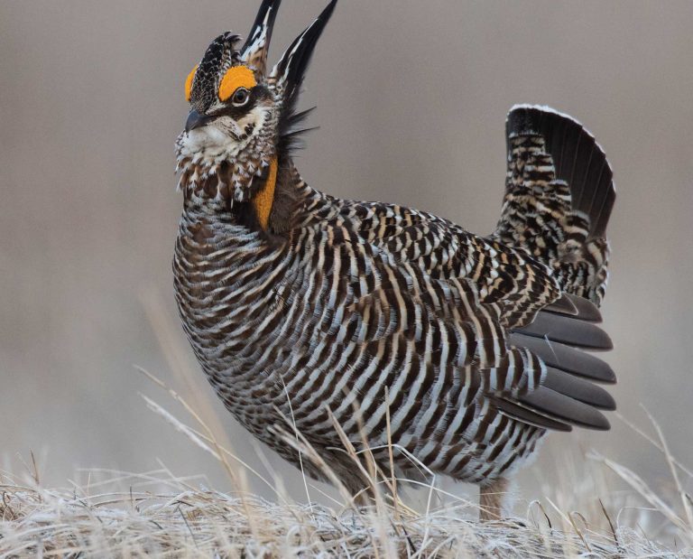
Sharp-tailed Grouse of Wisconsin – Firebirds of the Northwest Sands
How the Wisconsin Sharp-tailed Grouse Society Conserves the State’s Sharptails and A Globally Threatened Habitat.
During my time at Deerfield Elementary School in southern Wisconsin, my fourth-grade teacher taught us about Wisconsin’s geological history. I recall learning about glaciers, the formation of our local drumlins, and how unique the unglaciated driftless area is when it comes to midwestern landscapes. However, I don’t recall Mr. Meyer teaching my class about the endangered sandy pine barrens located in the northwestern part of the state.
This habitat type was also formed by glaciers, although they had the opposite effect. This expanse of poor-quality, sandy soils is exactly where the glaciers scraped across the surface of what is now Wisconsin. Post-ice age, pine barrens covered 2.7 million acres in this region. Sadly, interconnected barrens broken up by young stands of jack pine are difficult to come by these days. In fact, pine and oak barrens are a globally threatened habitat type.
“Red, white, and jack pine as well as oak and some aspen were present in historic pine barrens, but in patches, not large swaths of forests,” said Mike Amman, the Bayfield County forester and the Vice President for the Wisconsin Sharp-tailed Grouse Society. Amman continued, saying that reforestation created dense stands of red and jack pine, which were and are managed for timber production. However, the tree density and sheer total acreage of these areas came at the expense of the historically open barrens. Barrens-related species’ populations have fallen drastically, including the sharp-tailed grouse.
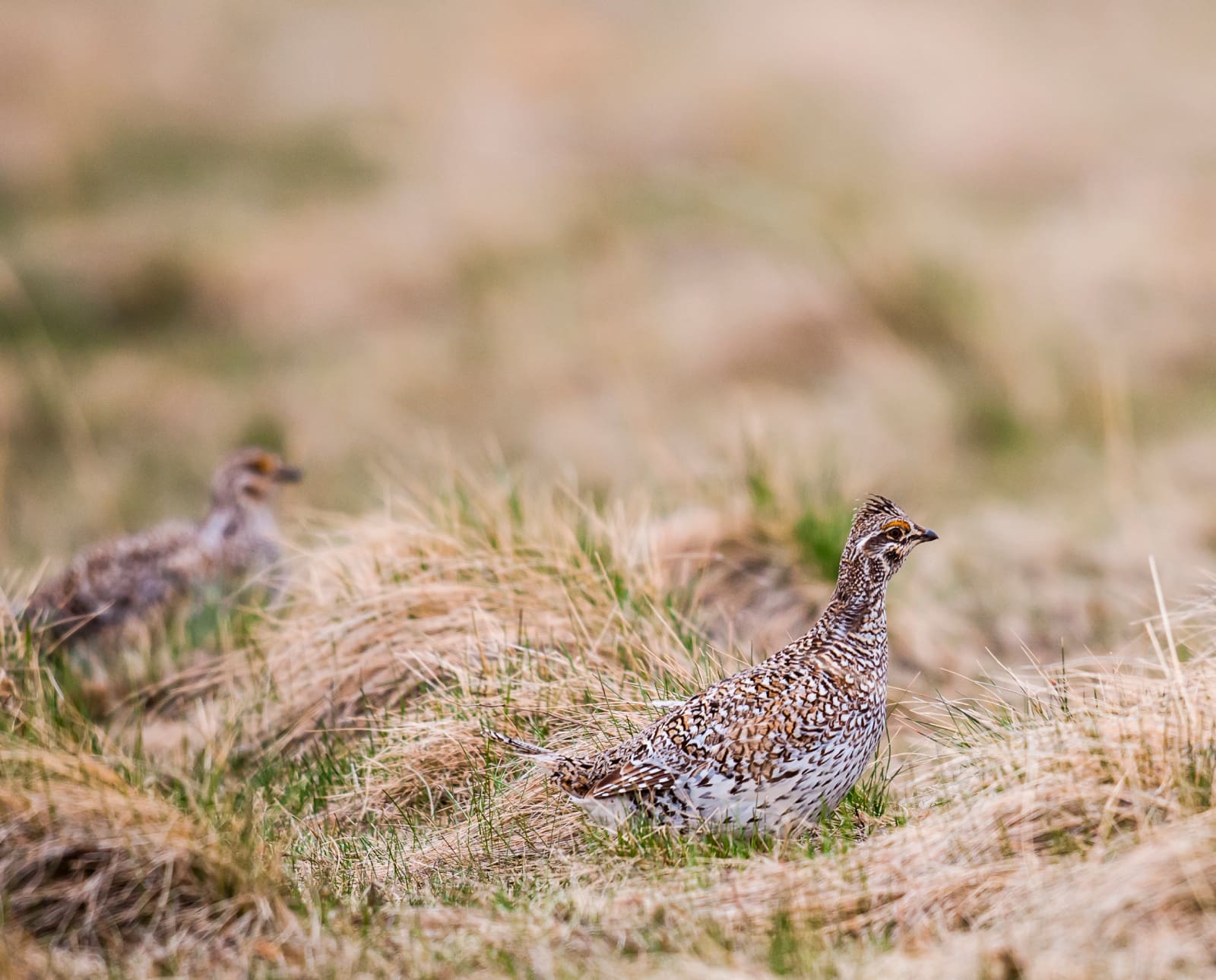
Sharpies are Wisconsin Residents
When uplanders typically think of sharp-tailed grouse habitat, North Dakota, Nebraska, and Montana come to mind. Historically, Wisconsin was also included on this list. However, after European settlement, the impacts of clearcutting, fire suppression, farmland conversion, and residential development almost eliminated pine barrens and sharpies along with them.
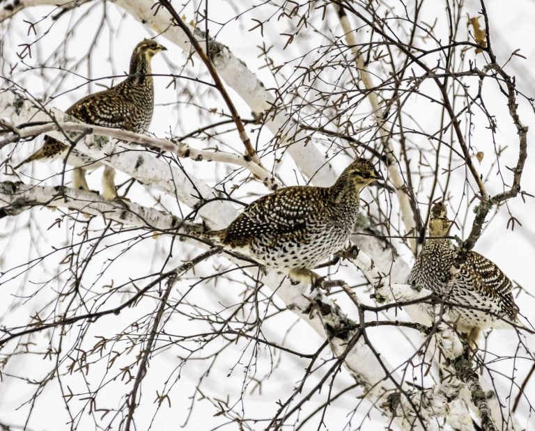
The Wisconsin Department of Natural Resources (DNR) states that in the past, sharptails covered much of northern and central North America. They recognize six subspecies of sharpies; the prairie sharp-tailed grouse subspecies (T. phasianellus campestris) is one that resides in the state year-round.
A brochure available on the DNR website depicts the distribution of the birds in the state over time. In 1850, sharpie habitat covered much of central Wisconsin, the entire northwest sands region, portions of the driftless area, and the southeastern corner. The DNR calculates that prior to European settlement, 13.2 percent of northern Wisconsin was sharptail habitat.
Fast-forward to 2000, and the infographic highlights 19 tiny, disconnected ovals of known grouse locations. A lack of fire disturbance has reduced the sharptail distribution across Wisconsin. It has also fragmented the barrens habitat the species relies on. The agency estimates that less than one percent of the original pine and oak barrens exist today. Additionally, less than one percent of native grasslands that sharptails rely on remain. The combination of these factors supports the need for sharptail conservation in this state.
The DNR classifies sharpies as a “Species of Greatest Conservation Need.” As a result, this species is intensively managed across their range, particularly in Douglas, Burnett, and Bayfield Counties, as well as west of Minocqua near Highway 70. Today, this core group of public properties and private lands are the only places sharp-tailed grouse exist in Wisconsin.
“The northwest sands are the last stronghold for sharptails in Wisconsin,” said Amman. In the past, the average interval between fires was ten to 15 years. Since fires haven’t been occurring at this rate for decades, today, most of the northwest sands are forested and inhospitable to the birds.
How Sharptails are Managed in Bayfield County
Mike Amman is the forester for Bayfield County. As a steward of the land, he manages tree growth and sharptails simultaneously. He strategically carves out spots within forested landscapes to hold onto these birds while contributing to broader landscape management.
“Historically, the Bayfield County Forest held birds in its fuel breaks,” said Amman. The properties he manages are in a fire-prone area, so they keep large areas open as fire breaks when possible. Traditionally, these were long, rectangular, quarter-mile long by eight-mile wide gaps in the forest.
While he was maintaining these fire breaks, sharptails survived in the forests on a small scale. However, bowling alley-style fire breaks weren’t the most effective for conserving sharptails. With a lot of help from the DNR, Amman was able to transition away from that style of fire break to a central core area while maintaining the same acreage. Bayfield County already had sharptails on its property; Amman just had to improve its quality a little to help strengthen the breeding population of these birds.
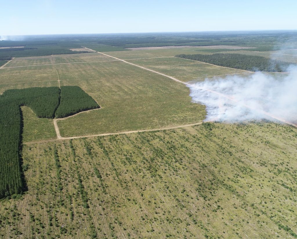
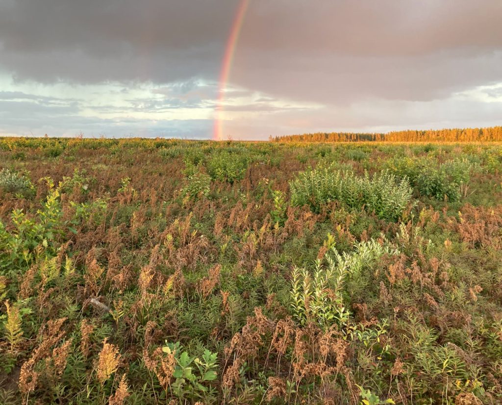
Today, Bayfield County forests are undergoing an intense management plan: the Barnes Barrens Management Plan. Scheduled to run from 2020 through 2082, county foresters will implement the plan in two different stages. Stage one prioritizes establishing the “core area” for barrens habitat within the Bayfield County Forest. It also includes removing mature red pine trees and transitioning the land into a jack pine forest. Mature stands of jack pine will be harvested, too. These efforts work towards restoring barrens and young jack pine; this specific tree and age class are beneficial for many native barrens species, including the state endangered Kirtland’s Warbler.
Stage two focuses on creating “floating surrogate barrens.” Beginning in 2035, the forest’s four zones will be rotationally harvested as each pine stand matures. As each stand is cut, the newly opened forest will serve as a surrogate barrens for sharptail grouse. If things go according to plan, the grouse will have a new barrens location to occupy at the same time the previously harvested area begins to reforest. To me, this is a unique and effective way to manage both timber and grouse at the same time.
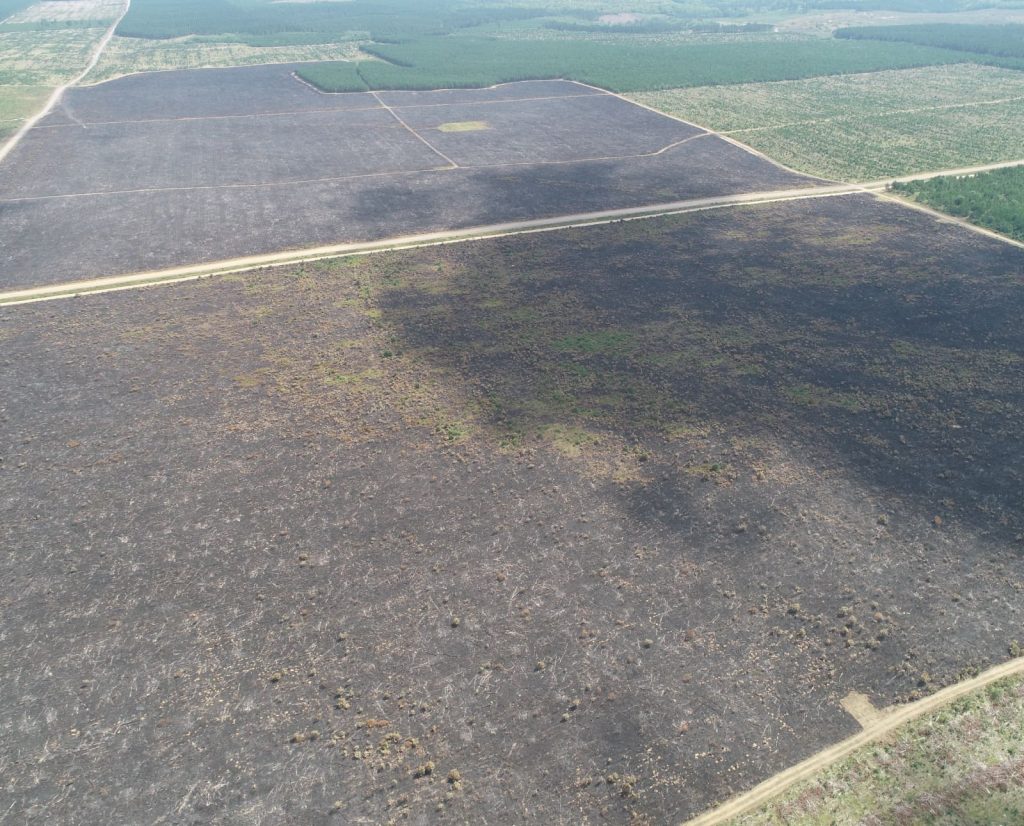
To facilitate these plans, Bayfield County Forest will employ several land management techniques. Prescribed fire will help moderate grasses and brush, and chemical-based vegetation treatments will stave off reforestation. Their use of scarification and seeding of jack pine supports naturally-growing pine stands as opposed to linear rows of planted seedlings. Working with other professional land managers from the DNR and Forest Service is included in the plan, too, to ensure the use of up-to-date science and best management practices. Most importantly, all of these techniques will be applied in ways that ensure continuous connectivity with the central core area of barrens habitat. This way, local sharpies always have the largest intact tract of barrens available for use.
Amman understands the depth and importance of long-term grouse management in his neck of the woods. “I’m engaged at the ground level. I can say, ‘Alright, how do we make sure we’re doing our best with the county forest? How do we advocate for the state to keep doing good work? How do we help connect our land base with the Forest Service and these other isolated populations?”
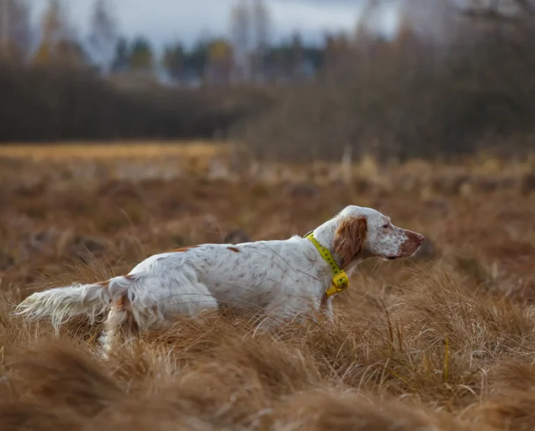
In addition to following the management plan, Amman uses technology to monitor sharptails. GPS collars—well, backpacks, really—are used to collect data every hour on the forest’s birds. To do so, researchers must first trap sharp-tailed grouse and mount the GPS unit to their back. This is done carefully as live birds are very fragile. Each backpack never weighs more than three percent of a grouse’s body weight.
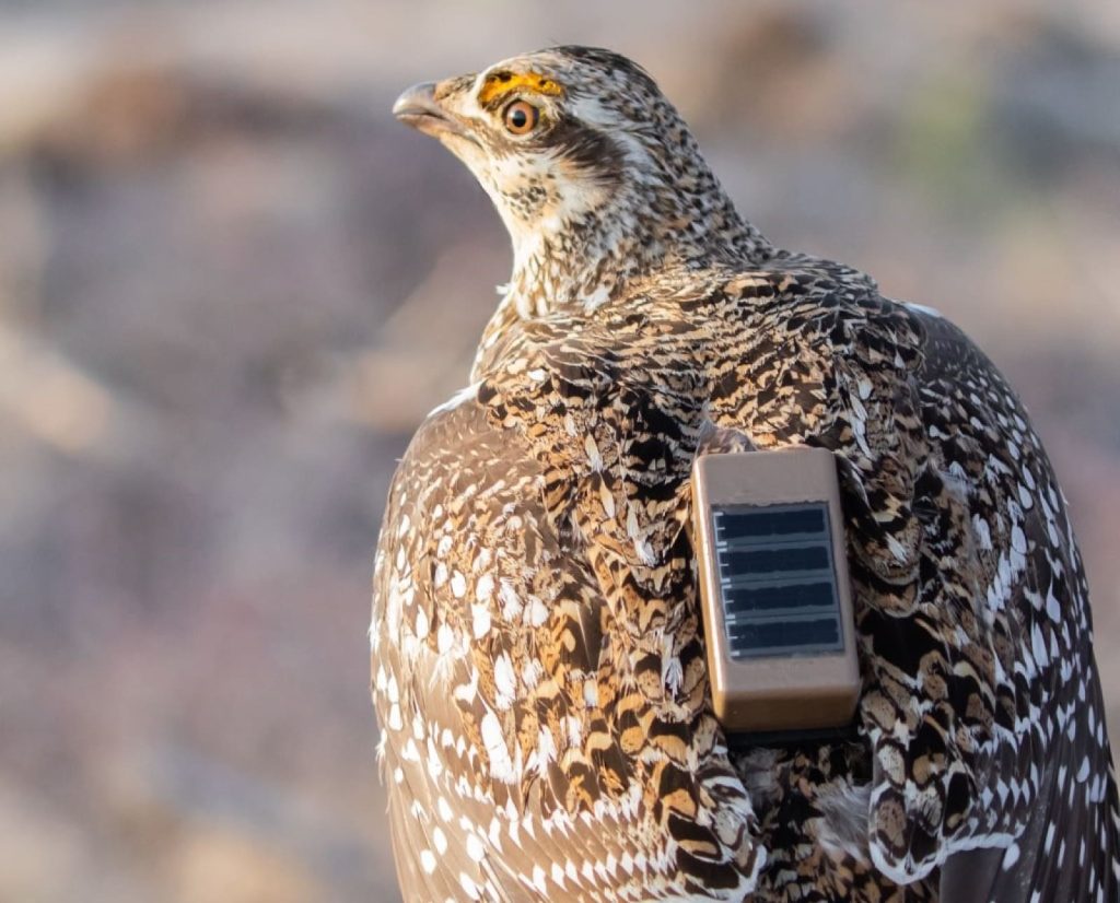
When they work, GPS units can tell us where birds roost, feed, nest, raise broods, and more throughout the year. Additionally, they can tell us precisely where grouse aren’t, furthering our understanding of habitats they depend on and places they avoid.
“These areas are just postage stamps. One thousand acres is nothing to these birds. I have to make sure my postage stamp is as high-quality as it can be. When we get the GPS collars on, we can see what aspects of the stamp they use. We can build movement maps with this information,” said Amman.
However, trapping and attaching GPS units to grouse is far easier said than done. A monitoring project completed in 2021 successfully captured and GPS tagged just seven sharpies, and six of them were male. Male grouse behave differently than female grouse and may use slightly different areas as a result. Delays in understanding areas that female grouse prefer may lead to negative impacts on chick survival. Unfortunately, the only tagged female died due to predation just one month after being tagged. To make things worse, the GPS units on the male grouse all stopped working over time, leading to gaps in data collection.
“When your sample size is five, data analysis gets really tough,” explained Amman.
Whether or not these expensive GPS units can be reused after a mortality event or loss of signal depends on several factors. Predators can destroy the tags while preying upon birds, or the device can simply malfunction. Luckily, in these instances, they usually emit a mortality signal so managers like Amman can locate the device even after it has fallen off.
“When our GPS technology fails, I go out and look for it,” he said. “As part of that, I take my dog with me in the field and we flush birds. If we can flush birds and I can record how many young birds flew, I can collect data points and learn if our management techniques are working.”
Despite the challenging start to the GPS monitoring efforts, Bayfield County is committed to supporting this effort long-term. Additionally, they have an interest in expanding the GPS-based project to other DNR properties with barrens on them. Hopefully, the growth of this program will help tell wildlife and land managers more about this imperiled species.
How Sharptails are Managed by the Wisconsin Department of Natural Resources
The Wisconsin DNR started managing sharptails in the 1940s. One of the first things they did was designate sharptail management areas. Today, the DNR collects sharptail data in those eight core locations in northern Wisconsin, including: Crex Meadows Wildlife Area, Douglas County Wildlife Area, Kimberly Clark Wildlife Area, Moquah Barrens Wildlife Area, Namekagon Barrens Wildlife Area, Pershing Wildlife Area, Riley Lake Wildlife Management Area, and the property Mike Amman helps manage, the Barnes Barrens in Bayfield County Forest.
As expected, the state uses some tried-and-true land management techniques to support barrens restoration and sharptail conservation on their properties. Similarly to the Bayfield County Forest, the DNR practices prescribed burns and mowing. These techniques create islands of cover habitat and support native grasses and forbs, critical habitat elements for sharpies and other at-risk barrens species.
Bob Hanson, the Northwest Sands Wildlife Biologist and Sharp-tailed Grouse Species Coordinator for the DNR, is the person in charge of increasing habitat connectivity for the species. “We’ve got this fire-adapted system that reacts very well to prescribed burning. The shrubs, prairie, and tree species all mix together to provide habitat for the sharp-tailed grouse and other rare species. When you add it all up, it’s quite a mix of wildlife who are using these barrens. It’s why the barrens are considered globally important,” said Hanson.
Additionally, the state published a document titled “Wisconsin Sharp-tailed Grouse: A Comprehensive Management and Conservation Strategy” in 2011. The Sharp-tailed Grouse Working Group keeps this public document up-to-date. This plan was created after identifying a lack of genetic diversity and “high levels of inbreeding relative to more continuous populations.” The second half of the 68-page plan explains the state’s management plans, focus areas to prioritize, and measurable action items.
The ultimate goal of the state’s conservation plan is to sustain viable populations of genetically-sound sharptails that provide regulated hunting opportunities. The actionable items intended to help managers reach that goal in 10 years include establishing grouse conservation areas, evaluating annual reproduction rates, identifying landowner partners, conducting land surveys, and more.
To help achieve this goal, the DNR developed the Northwest Sands Corridor Plan. Published in 2013, this plan identifies opportunities to connect existing pine barrens habitat. Its objective is to use “biologically‐driven data to identify barrens habitat restoration opportunities within the Northwest Sands and potential habitat corridors or stepping stones between existing barrens habitat patches, with the ultimate goal of benefitting barrens‐dependent Species of Greatest Conservation Needs” such as the sharp-tailed grouse. The DNR uses this plan to prioritize restoration areas to ensure habitat connectivity.
“The 1996 Sharp-tailed Grouse Plan said you should have about 50,000 acres of quality habitat for the species to be sustainable. We never really identified where that would be back then, but today, the birds are showing us where that is,” said Hanson. “However, these places are too far apart and that’s where the habitat corridor plan comes into play. We need to create suitable habitats along that corridor no more than 3 miles apart and at least 1,280 acres in size to reconnect this landscape.” Hanson’s hope is that source populations of sharptails will use these stepping stone-style habitat corridors to reconnect with other existing grouse populations.
The DNR does this work with multiple partners including the Bayfield County Forest, the state forest, private industrial landowners, conservation easements, Douglas County, Burnett County, and more. Each partner seeks to achieve different goals by working with the DNR, whether it’s increasing the size of their barrens habitats or increasing the connectivity between their different properties. Ideally, all of this work will greatly benefit the sustainability of sharp-tailed grouse populations in Wisconsin, ultimately leading to a regulated hunting season.
Right now, the DNR does not allow sharptail hunting in Wisconsin; the state requires a permit to hunt this species and the permit itself is currently “under review.” Managers aren’t quite sure when the season will reopen. “Right now, as we draft this plan, we’re trying to figure out what to do. We had a population viability analysis done last year that said if we continued on our previous path, we could be increasing the risk of extinction over time,” said Hanson. “The advisory committee recommended that we don’t hunt them until we figure out a new model for the permit quota system.”
The DNR also conducted intercept interviews with grouse hunters training their dogs on sharptails on public properties. “The majority of people said that they want to hunt sharptails once the population is sustainable; it was all about the bird and making sure they’ll be okay first,” said Hanson.
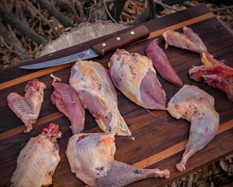
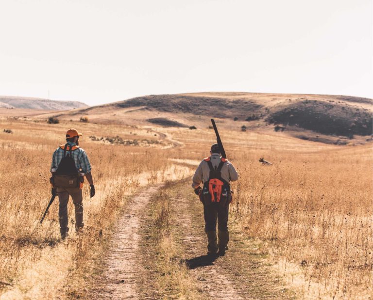
Amman thinks that when the 2023 sharptail management plan is completed, there will be guidelines included as to when a hunting season will be allowable. However, in the meantime, it is still legal to train your dogs on resident sharptails for open sharpie seasons elsewhere. Just keep in mind that sharpies live in the dog training restrictions area.
Amman chimed in with his personal opinion on this topic. “We’re still seeing grouse population growth on these focal properties,” he said. “If they’re growing, let’s let them grow. Once we see dispersal onto other properties, then those focal properties are considered ‘full.’ Then we’ll have a source population; we’ll be able to hunt a source population.”
How Sharptails are Managed by the U.S. Forest Service
The U.S. Forest Service (USFS) manages the sharp-tailed grouse present in Wisconsin’s Moquah Barrens and Riley Lake Management Area in the Chequamegon-Nicolet National Forest. There, the agency has been managing for sharptails since the 1950s via prescribed fire. In 2009, they completed a 22,000-acre management plan that outlines the management objectives for the area. It focuses on conserving the “unique and globally imperiled pine barrens ecosystem.” Similarly to the other managers working with barrens, the Forest Service uses fire, timber harvests, invasive species removal, native seed planting, and ongoing monitoring to manage this habitat type.
Unlike Bayfield County’s and the DNR’s management strategies, though, the Forest Service has translocated grouse from Minnesota to Wisconsin. Between 2016 and 2018, 160 sharpies were moved from northwestern Minnesota to the Moquah Barrens. The goal was to introduce more genetic diversity into the inbred Wisconsin population. In addition to following recommendations written in the Wisconsin Sharp-tailed Grouse Management Plan, the Wisconsin and Minnesota DNRs, Sharp-tailed Grouse Committee, and Minnesota and Wisconsin Sharp-tailed Grouse Societies all provided translocation recommendations to the USFS. This project was a team effort, no doubt.
So far, the USFS project has had mixed results. Initially, grouse numbers bumped up post-translocation as birds stuck around for the first year. Since then, grouse managers have had a difficult time collecting data on translocated birds.
“The birds have been bouncing around and trying different lek spots,” said Hanson, who helped trap and release sharptails for the federal project. “What we’re looking for this spring is increased access to lek locations and getting a better bird count. For example, the Moquah Barrens roads don’t get snow plowed at all, so we’ve missed a lot of our lek survey periods in the past due to lack of access, forcing us to miss data collection opportunities.”
“There may be several factors at play for the numbers of birds seen at the known lek sites at Moquah this last spring,” said Brian Heeringa, the District Wildlife Biologist for Wisconsin’s Chequamegon-Nicolet National Forest. In addition to minimal personnel and the remote nature of lek sites, the USFS “figures that around 50 percent of them dispersed out of Moquah and perhaps up to an estimated 20 percent suffered from predation.”
Fortunately, private citizens have been reporting brood sightings throughout the northwest sands, assisting with data collection efforts. “It’s a positive thing. Plus, we’ve had mild spring weather for the last two years. They’ve been dry with no ice storms or late snows, which is great for nesting conditions. I’m guessing we’ll see another jump up in the bird numbers,” said Hanson.
Although data collection has been difficult, released birds have been documented inside and outside the National Forest property. Dispersal distances of released birds have ranged from a quarter mile to nearly 25 miles according to the USFS’s radio telemetry data. The farthest-traveling bird was a harvested bird from Namekagon Barrens, “a straight-line distance of over 50 miles,” said Heeringa. Not only that, but these birds have been seen at active and historic lekking grounds throughout the Moquah Barrens and on state and county lands.
“It was fascinating,” Amman said, his eyes lighting up. “We moved these Minnesota birds to what we thought were good Wisconsin properties. Yet some birds left and flew to historic lek sites that haven’t been active in decades. Those birds had never been in this state before. The environmental cues they saw in the air were enough to get them to think, that’s where I want to be. It’s not random. They’re seeing something in the environment that we don’t.”
Today, researchers are mapping historic lek sites. With this information, managers can prioritize areas featuring historic leks and open them up for sharptail utilization. The USFS also intends to ramp up their monitoring program. “The USFS is dedicated to supporting sharp-tailed grouse conservation into the future,” said Heeringa.
In addition to managing the Moquah Barrens, USFS works with other stakeholders to increase the connectivity between the historic northwest sands corridor in northern Wisconsin. “They’re planning to continue to do habitat work along their core management areas,” said Hanson. “Some of their timber harvests are going to act as floating barrens, too, and provide temporary open barrens that’s beneficial for species like the sharp-tailed grouse.”

The Future of Sharp-tailed Grouse in Wisconsin
Sharptails earned their nickname because of their propensity for survival on fire-prone landscapes. However, due to fire suppression and more, this charismatic species has nearly been extinguished from Wisconsin’s glaciated landscape. The lack of available habitat isn’t just negatively impacting this one species, either; countless uncommon, rare, and endangered species depend on this disappearing habitat type.
“We’re trying to reconnect just 50,000 existing acres of grouse habitat. It’s easy to see why the bird is struggling,” said Hanson. “However, there’s a mutually beneficial opportunity to support both the grouse and the working forest. Instead of spending money to create barrens habitat, stakeholders can make money clearing the trees for sharptails.”
By facilitating partnerships between county, state, and federal agencies as well as private landowners, hope remains for the longevity of Wisconsin’s firebirds and the pine barrens they depend on. Creating connections between land managers and, consequently, remaining pockets of barrens encourages connectivity between human relations, at-risk wildlife populations, and endangered landscapes. To me, it seems like this strategy is already working.
The DNR is finalizing the first draft of the Wisconsin Sharp-tailed Grouse Management Plan for 2023-2033. You can read it here. The state recently opened a public comment period for the draft plan that closed on November 17th. If you’re looking for ways to get involved with sharpie management in the state, consider reviewing the final draft of the plan, providing some feedback to the DNR, and watching the recording of the recent public comment meeting held on November 8.
“We need all hands on deck. It’s not just about sharptails,” said Amman. “It’s about all the species that depend on the barrens.”
To support and stay up to date on Wisconsin sharp-tailed grouse management, join the Wisconsin Sharp-tailed Grouse Society. You’ll receive quarterly updates, additional resources, connections to fellow sharptail advocates, and more.