Home » Turkey Hunting » E-Scouting for Wild Turkeys in the Southeast
E-Scouting for Wild Turkeys in the Southeast

Patrick Hunter was born and raised in the Carolinas. He…
Advice and best practices for e-scouting southern wild turkeys from the couch
I love the challenge presented by hunting wild turkeys in the Southeast. The birds exhibit unique behaviors based on the region and landscape of their home range. Thankfully, e-scouting wild turkeys can help hunters craft their approach to hunting these birds down south.
In the mountains and foothills, easterns act like the wild turkeys out West. They range out from their roosting locations and can move miles on a whim. In the Piedmont and Sandhills regions, turkeys won’t travel as far and will typically be centralized around agricultural land or rivers and creeks.
In the coastal regions, turkeys will rarely leave their 50- to 100-acre home range. Most often, these landscapes have swampy hardwood bottoms and wetlands. Coastal turkeys are the most challenging as they seemingly have a constructed stronghold in these lowland wet areas and love to roost above water. Sneaking up to a bird, even on the roost, is a challenge because they will most often hear or see you coming.
The best way to fill turkey tags in the Southeast is to scout. Thanks to modern innovations, e-scouting can be done from the comfort of your couch on your mobile device. Applications like onX Hunt aid in evaluating a hunting area to best determine where to find roosting turkeys or their home range.

E-Scouting for Turkeys In The Mountains And Foothills
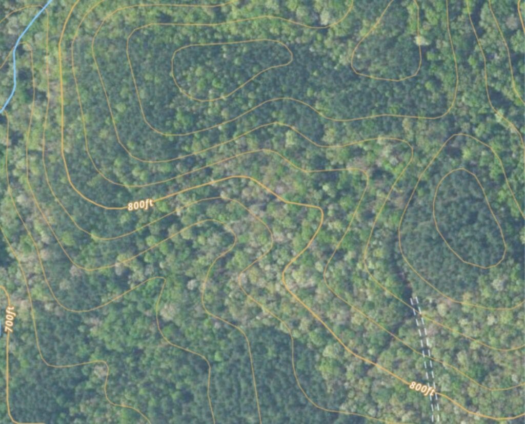
Topography is a major aspect of scouting for turkeys in the mountains and foothills. Turkeys are much better runners than flyers, but they can pitch off a limb and soar a long way if the topography allows.
It sounds silly, but when finding roost locations for turkeys in this region, imagine you are a Wright brother. Find a ridge with a good take-off point. The anatomy of a wild turkey is very similar to that of the first airplane. With a long, wide wing span and a large tail fan for stability, a wild turkey in flight and a glider are functionally the same.
In the mountains and foothills, search for ridges with good roost trees seemingly lower down on the slope. They should also have a plateau or bowl that allows for a soft landing and forage. Saddles are great topographical features to look out for, especially close to water. When looking at a topographical map, a saddle is two ovals that are close to one another on the same contour line, but are not connected. A bowl or plateau is the area at the “seat” of the saddle feature.
Another contour feature to look for are blue line creeks. Wild turkeys, like all animals, need water. Additionally, water in the mountains and foothills are lined with water-loving plants. These plant species are insect havens. Turkeys will consume both the leafy greens and the bugs on these plants.
Additionally, like human roads and highways, creek bottoms are wildlife corridors. Setting up close to creek bottoms can be effective to both locate gobbling turkeys and bisect their travel.
E-Scouting The Piedmont and Sandhills Regions
Food sources and nesting cover close to roosting locations are critical in the Piedmont and Sandhills regions. While turkeys may roost in thick hardwoods, they forage in the open pineland savannah in the Piedmont and Sandhills regions. Food is abundant, they can see openly for miles, and the native bunchgrasses allow for great nesting habitat for hens.
In the springtime, there are two windows of opportunities for Piedmont and Sandhills hunters: sunrise to about 9:00 a.m., and noon until the end of legal shooting light. When hunting in the afternoon here, make plans to set up near transition areas. Find the middle of the slopes on topographic maps. After the midmorning slow period, turkeys move out of the dense, thick wet areas and move into agricultural fields or open pinelands.
If you hear turkeys gobbling in the lowlands at sunrise, but they do not come to you, stay in that area until the afternoon. However, if you have to leave and come back, make a plan to set up in the afternoon about 100-200 yards from that gobbling area. It is likely that as those toms begin to move from lowland to highlands, they will pass through your setup. Most importantly, do not over-call in the afternoons. Subtle calls every 15 to 30 minutes should help close the deal.

E-Scouting In The Coastal Region
When e-scouting and hunting in the coastal region, contour lines are not as useful; elevations may only change a few feet every mile. Instead, pay attention to places where wet and dry areas come together.
While e-scouting, use a topographical map and hybrid map and evaluate areas that are classified as wetlands on the topo map setting. Then, look on the hybrid map setting for access roads, openings, tree density, and tree spacing. Areas of wetlands between highlands or dry areas can be great features to look for when planning your turkey hunt.
Once the wetland area has been identified, locate the areas on the hybrid map where there are dense hardwoods close to water. These areas will look like green, fluffy circles. Then, find the areas that are less green and look more gray or brown. This indicates a more open area in the wetlands.
Note that in the wetland areas, the topo setting will not always show areas that hold water. So, if you find an area on the hybrid map that looks like a dark blueish-black oval, this area is a pond when the water levels rise. Turkeys like to roost near water, but not in the water. Even a ponding area in a swamp can deter a turkey, so avoid these areas.
While On The Ground In Coastal Country
When planning a morning hunt in the coastal region, be 200 yards or more from a water feature. In that 200-ish yards, look for an area of dense hardwood canopy with an open midstory and mostly open understory. Set up 100 yards from the dense hardwoods, as that is where turkeys are most likely to roost. Places like this must be confirmed from the ground, but e-scouting can help you weed out areas that are less ideal.
While on the ground, look for palmetto fronds, bunch grasses, or even young pines. Be careful, though, because this is a shared home of alligators and snakes. While scouting from the ground, if you find an area that is muddy or holding water, avoid it and find an area that is dry. Turkeys, like us humans, do not enjoy trudging through mud and muck. If a turkey could sink up to their spurs, the mud is too deep.

Tips For Scouting for Southeastern Wild Turkeys On The Ground
Once the desired areas on the map have been found and waypoints have been dropped, go scout on the ground and listen for birds in the morning.
Calling While Scouting
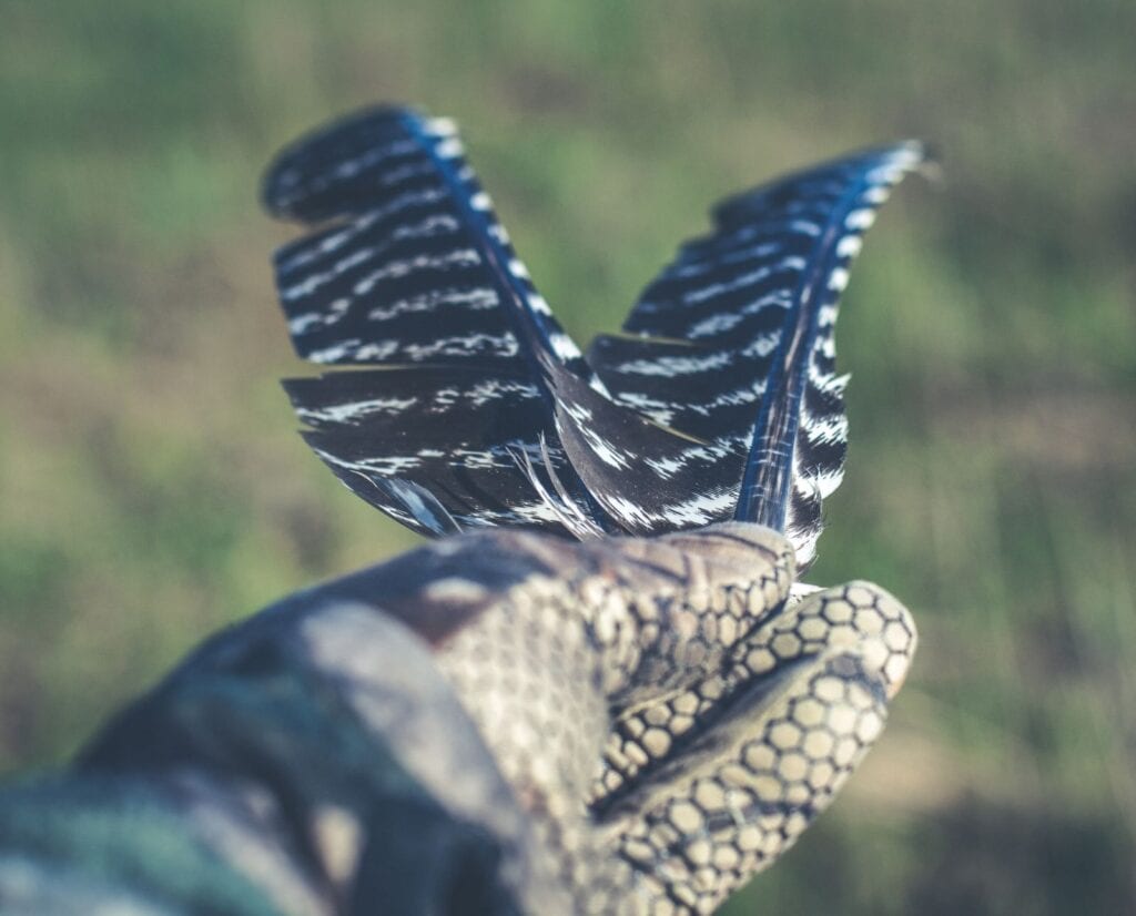
When scouting in person, do not use a turkey call. A turkey call should only be used when hunting. Instead, use crow calls or owl calls to produce a shock gobble to locate turkeys before your hunt. Observe the ground and look for leaves and pine needles moved into clumps—this could be turkey scratching sign. Finding turkey feathers or footprints in these areas will confirm the scratching because animals like armadillos and hogs can create sign similar to turkey scratching.
Note Fresh Sign And Changes In The Landscape
When scouting, pay attention to turkey tracks in the road. Take mental note of the direction the turkey was traveling, as well as if they ran down the road parallel or across the road perpendicular. This can be a useful tool to confirm or rule out waypoints marked on a mapping application.
Lastly, continue to scout while you hunt. If you notice turkey sign in an area that you ruled out on the map, take a look from the ground. Mapping programs are not always up to date. Tracts of land could have been clear cut, thinned, or burned very recently, and those features will not show up online. These new disturbances can be excellent hunting areas, as wildlife will move into the disturbed areas for forage.
E-scouting for turkeys in the Southeast requires a region-specific approach that accounts for the diverse landscapes of the mountains, Piedmont, Sandhills, and coastal areas. By using tools like topographic and hybrid maps, hunters can identify key features such as roost-friendly ridgetops, creek bottoms, transition zones, and wetland edges—often from the comfort of home. Whether you’re tracking high-ranging mountain birds or patterning tight-ranging coastal toms, effective e-scouting can mean the difference between a quiet morning and a punched tag.
Patrick Hunter was born and raised in the Carolinas. He grew up in the foothills of the Appalachian Mountains where he fell in love with hunting, fishing and the outdoors. As a third generation hunter, Patrick has a deep rooted legacy in hunting, especially for quail and ducks. Patrick's hunting companion is Huck Finn, 5-year-old black Labrador Retriever. Outside of hunting, Patrick is an avid fly fisherman, fly tyer, freelance writer, and photographer. Patrick is an environmental engineer by trade, and works to conserve the water resources, wildlife, and the wild places of the Carolinas. Today, Patrick lives in South Carolina with his wife, Katie, and daughter, Jane.


